The Benton MacKaye Trail, named after the regional planner who envisioned the Appalachian Trail, begins at the same location as the Appalachian Trail on Springer Mountain and extends 300 miles journeying into deep remote areas within our own Fannin County to the northeastern edge of the Great Smoky Mountains National Park.
For the first few miles, the Benton MacKaye Trail (BMT) and the Appalachian Trail (AT) overlap before branching off in different directions. Keep an eye out for the white diamonds which marks the BMT.
Blue Ridge is a Benton MacKaye Trail Town which serves as the first town along the Benton MacKaye Trail, which winds through Fannin County, traversing the Cohutta Wilderness before continuing into Tennessee and North Carolina.
Below are several access points in the Blue Ridge area. View the Benton MacKaye Trail Guide
BEGINNING OF APPALACHIAN TRAIL, south of Blue Ridge
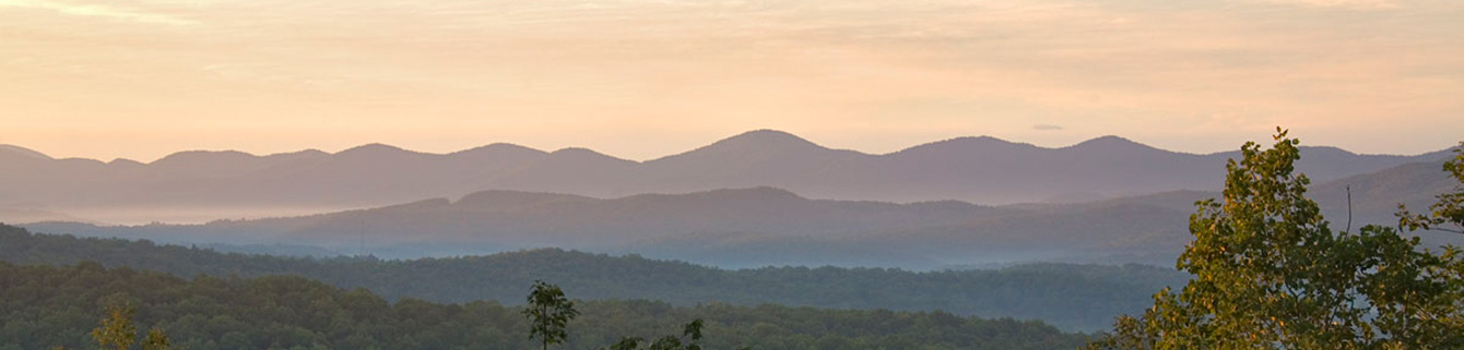
Springer Mountain
Access to the starting point of the Benton MacKaye and Appalachian Trail is in southern Fannin County at Springer Mountain. From Blue Ridge, take Aska Road 13.5 miles until it deadends into Newport Road. Turn right on Newport Road, go 4.5 miles until it dead ends into Doublehead Gap. Turn right on Doublehead Gap and go 2 miles to FS Road 42 (on the left). Turn left and go approximately 6.5 to 7 miles to the parking area on your left. A short hike from the parking lot (across the street) leads to the summit. ...
The Benton MacKaye Trail, named after the regional planner who envisioned the Appalachian Trail, begins at the same location as the Appalachian Trail on Springer Mountain and extends 300 miles journeying into deep remote areas within our own Fannin County to the northeastern edge of the Great Smoky Mountains National Park.
For the first few miles, the Benton MacKaye Trail (BMT) and the Appalachian Trail (AT) overlap before branching off in different directions. Keep an eye out for the white diamonds which marks the BMT.
Blue Ridge is a Benton MacKaye Trail Town which serves as the first town along the Benton MacKaye Trail, which winds through Fannin County, traversing the Cohutta Wilderness before continuing into Tennessee and North Carolina.
Below are several access points in the Blue Ridge area. View the Benton MacKaye Trail Guide
BEGINNING OF APPALACHIAN TRAIL, south of Blue Ridge
Springer Mountain
Access to the starting point of the Benton MacKaye and Appalachian Trail is in southern Fannin County at Springer Mountain. From Blue Ridge, take Aska Road 13.5 miles until it deadends into Newport Road. Turn right on Newport Road, go 4.5 miles until it dead ends into Doublehead Gap. Turn right on Doublehead Gap and go 2 miles to FS Road 42 (on the left). Turn left and go approximately 6.5 to 7 miles to the parking area on your left. A short hike from the parking lot (across the street) leads to the summit.
Three Forks
A junction of the Appalachian Trail and Benton MacKaye Trail, located on FS Road 58 on Noontootla Creek. You can also start a 3.7 mile hike to Springer Mountain from Three Forks. From Blue Ridge, go south on Aska Road to the end. Turn right onto Newport Road, go 4.5 miles to end. Turn left onto Doublehead Gap Road, cross a concrete bridge and come to a gravel/dirt road. Follow the gravel road .3 miles to the intersection of FS Road 58, sharply on the right. Turn right into the forest and uphill 5.3 miles to Three Forks.
Long Creek Falls
Access the trail to Long Creek Falls across the road from the parking area at Three Forks. There is a gradual hike alongside Long Creek, with three short ascents before reaching the blue blazed side trail to the falls at 1.1 miles.
ACCESS IN THE COHUTTAS
Dyer Gap & Watson Gap
From Blue Ridge travel north on Hwy 5 for 3.9 miles to Hwy 2, take a left and go west on Hwy 2 until the road turns into a gravel Forest Service Road to Watson Gap. From the four-way intersection at Watson Gap, turn left and drive approximately 2.5 miles to Dyer Gap. It is highly recommended to get the USFS map of the Cohutta Wilderness and carry the 10 essentials.
Jacks River Trail (Dally Gap)
From Blue Ridge travel north on Hwy 5 for 3.9 miles to Hwy 2 and go west until the road turns into a gravel Forest Service road to Watson Gap. From the four-way intersection at Watson Gap, turn right and uphill onto FS 22, then go 3.4 miles to the trailhead at Dally Gap.
Thunder Rock Campground
This is a nice place to stop, park and start a hike or set up shuttles for long hikes. From Blue Ridge, take GA 5 north to McCaysville, then turn left on Tennessee Highway 68. In Ducktown, take U.S. 64 west to the Thunder Rock Campground on the left.
HWY 60 BETWEEN MORGANTON AND SUCHES
The Swinging Bridge
Here a 265-foot swinging bridge crosses the Toccoa River. From the bridge to Highway 60 is a 3 mile hike. North of Highway 60 the trail climbs Wallalah and Rhodes Mountains in a gentle arc as the trail swings from traveling northeast to northwest.
Swinging Bridge Directions
From Blue Ridge, take Hwy 515 east to Hwy 60/Morganton. In Morganton, follow Hwy 60 South toward Dahlonega for 11.3 miles passing Skeenah Mill. Another .7 miles on the right is FS 816. The parking lot for the hike in to the Swinging Bridge is across Hwy 60. If you prefer not to hike in, turn right and follow the gravel road 3 miles to the parking area. Short hike down to the Toccoa River and the Swinging Bridge.
Wilscot Mountain/GA Hwy 60 to Old Dial Road
Access point for the hike from Wilscot Gap over Tipton and Brawley Mountains to Old Dial Road.
Directions to Wilscot Gap Access
From Blue Ridge, travel north to the intersection of Hwy. 515 with GA 60 and continue (right) on GA 60 through Morganton toward Suches and Dahlonega. At just under 10 miles, the first crossing of GA 60 by the BMT will be seen at Wilscot Gap. A parking lot is located on the east side of the highway.
ACCESS FROM ASKA ROAD IN BLUE RIDGE
Shallowford Bridge
The trail parallels a stretch of the Toccoa River. The historic 175 feet long iron Shallowford Bridge was built in 1918.
Directions to Shallowford Bridge Trailhead
From Aska Road in Blue Ridge travel 8.4 miles to the Shallowford Bridge over the Toccoa River. Turn left, cross the river and watch for a parking area on the right. Access the trail at the intersection of Shallowford Bridge and Old Dial Road.
Falls Branch Falls
A double waterfall with mountain laurel and rhododendron growing along the trail and creek bank. This easy hike to the waterfall is about 30 minutes round trip. In Blue Ridge, follow Aska Road for 8 miles. Turn right on Stanley Creek Rd. (Toccoa Riverside Restaurant is on the left). The trailhead is about three miles on the right.